Castle Point Density and Capacity Study
Project details
- Client: Castle Point Borough Council, Essex
- 28 July 2025
- Castle Point, Essex
People involved
Specialisms
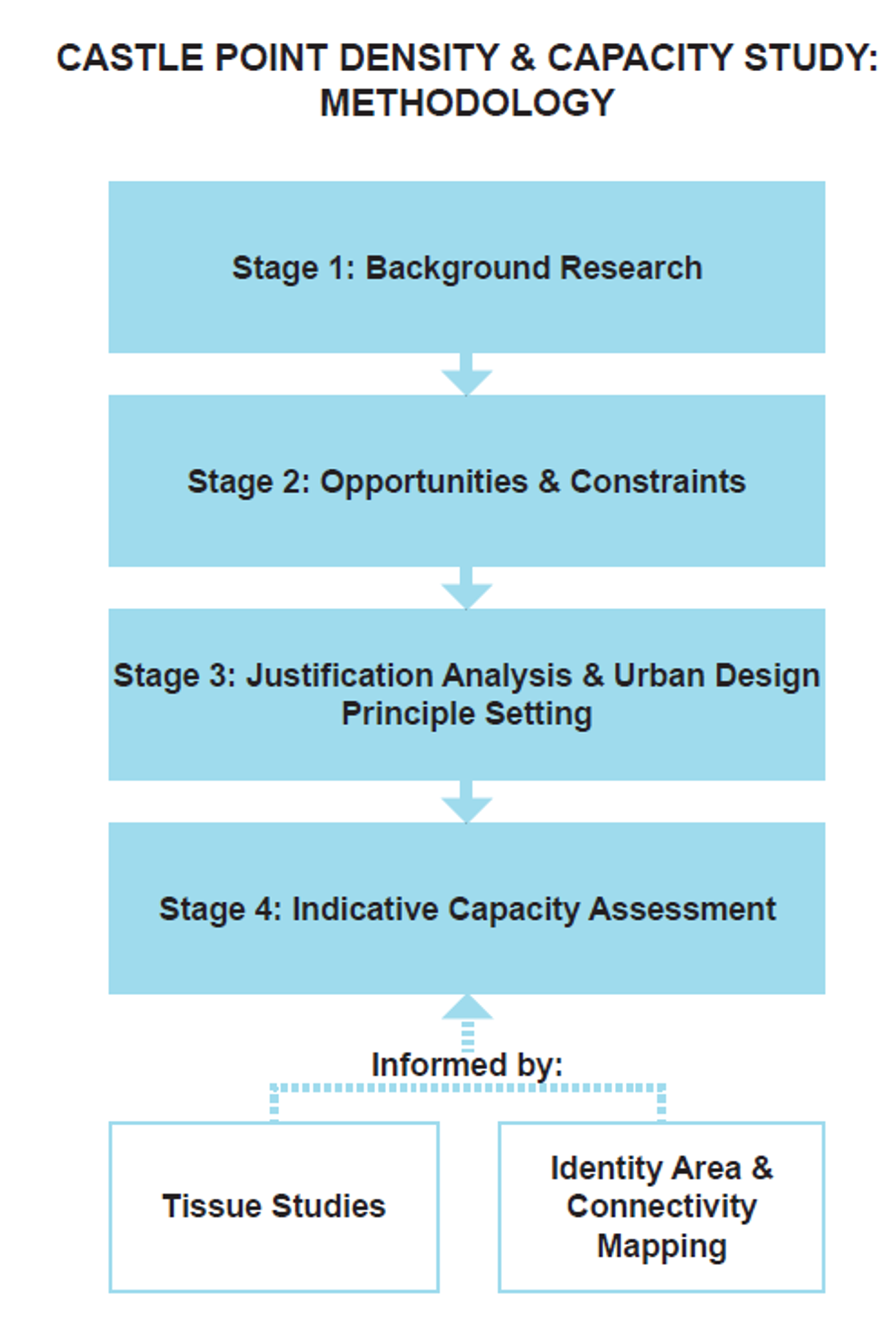
Place Services were asked to undertake a density and capacity assessment for Castle Point Borough Council (based on the emerging Design Code, also produced by Place Services) on a selection of sites to support the formulation of the Regulation 19 Submission draft Castle Point Plan. This work was split into four stages: Background Research, Site Opportunities and Constraints Analysis, Urban Design Principles Setting and Indicative Capacity Assessment, and Justification Analysis.
Stage 1: Background Research
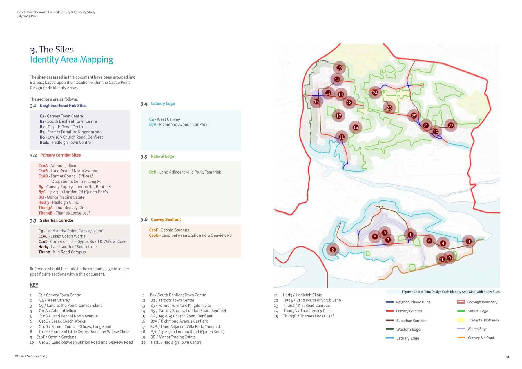
A desktop review of national and local policy documents, planning history, and site visits was conducted to establish a baseline for each site, informing subsequent density and capacity studies. Local tissue studies established the baseline density and precedents of higher-density developments supported the analysis, with the emerging Castle Point Design Code and its Identity Areas guiding the opportunities, constraints, and justification for potential density intensification.
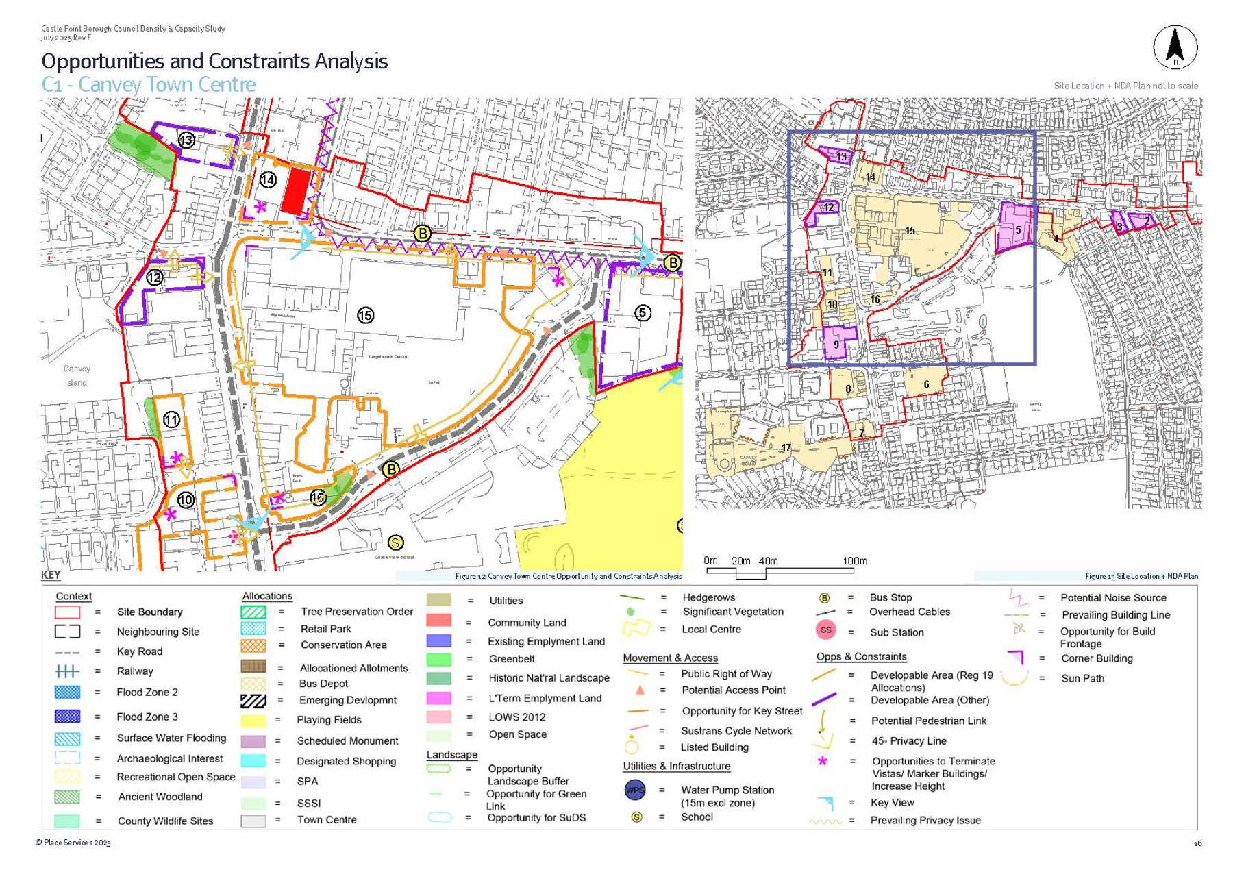
Stage 2: Opportunities and Constraints Analysis
Each site was assessed for its context, access, movement, layout, built environment, and landscape features, resulting in both an Opportunities and Constraints Plan and a Net Developable Area (NDA) Plan. Larger sites were divided into sub-sites for more detailed analysis, informed by the Castle Point Plan and local design codes. These assessments guided density calculations and development potential.
Stage 3: Justification Analysis and Urban Design Principle Setting
A Justification Analysis table was created for each site, summarising key findings from earlier stages and outlining urban design principles to guide future development. These principles include preserving green infrastructure, integrating active travel and public transport, responding to site topography and context, and ensuring sensitive treatment of heritage and views. Tailored to each site, these principles informed the final capacity and density assessments in Stage 4.
Stage 4: Indicative Capacity Assessment
An Indicative Capacity Assessment was developed for each site, presenting a density range based on earlier analysis and tissue studies. Lower density targets account for larger dwellings and mixed-use potential, while higher densities focus on smaller dwellings and apartments, with innovative parking solutions considered for well-connected areas. Local and wider precedent studies informed average densities and potential uplifts for each Identity Area, tailored to site context, connectivity, and character. These assessments aim to support sustainable intensification within settlement boundaries, with methodology adjusted for mixed-use and industrial sites where full redevelopment isn't feasible.